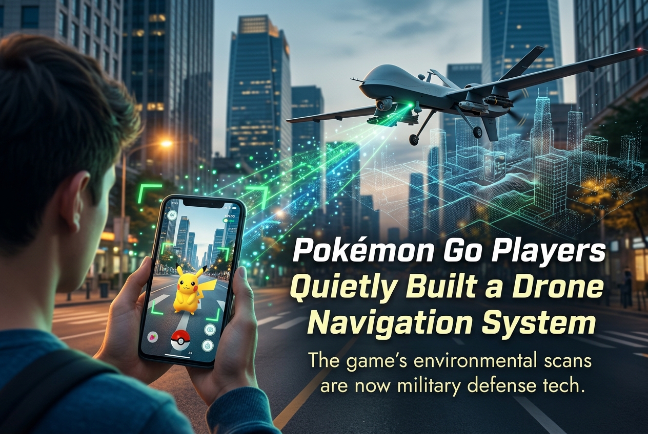
Billions of environmental scans submitted by Pokémon Go players trained a visual navigation system now being adapted for military drones that operate without GPS. Here’s how a mobile game quietly became defence infrastructure.
Roughly 30 billion environmental scans collected from Pokémon Go players since 2021 trained the Visual Positioning System (VPS) now at the centre of a defence partnership between Niantic Spatial and US-based military contractor Vantor. A June 2026 investigation by Dutch newspaper Trouw, subsequently reported by DroneXL, The Guardian, IGN, and dozens of international outlets, revealed that the crowd-sourced 3D mapping data originally gathered for in-game rewards has been repurposed to help drones and robots navigate in GPS-denied environments.
What Data Did Pokémon Go Actually Collect?
In 2021, Niantic introduced AR Mapping tasks to Pokémon Go. Players could earn bonus items by recording short 20-to-30-second video scans of real-world PokéStops and Gyms using their smartphone cameras. The feature was entirely optional and required separate consent. However, the terms of service players agreed to granted Niantic a “transferable and sublicensable licence” over the submitted scans, effectively allowing the company to resell the footage to third parties.
Players scanned statues, fountains, park entrances, building facades, and even interior spaces. Each scan captured rich metadata including the phone’s precise orientation, movement speed, direction, and GPS coordinates at the moment of capture. Over the years, Niantic accumulated scans from hundreds of millions of players across the globe, building what became one of the most detailed street-level 3D datasets ever assembled.
From Monster Hunting to Military Mapping
Niantic used this massive dataset to build its Large Geospatial Model, a spatial AI system that can determine a device’s precise location by matching what its camera sees against a pre-built 3D map of the world. Unlike GPS, which relies on satellite signals, this Visual Positioning System works by recognising surfaces, structures, and spatial features in the camera’s field of view, achieving near centimetre-level accuracy in scanned areas.
In March 2025, Niantic sold its gaming division (including Pokémon Go) to Saudi-owned Scopely for $3.5 billion. The company then restructured as Niantic Spatial, receiving $250 million in funding to focus exclusively on geospatial AI. Critically, the historical scan archive remained with Niantic Spatial, not with Scopely.
In December 2025, Niantic Spatial announced a partnership with Vantor (formerly Maxar Intelligence), a leading provider of spatial intelligence for defence and intelligence customers. Vantor holds a $70 million National Geospatial-Intelligence Agency contract and signed a separate deal with the US Army worth up to $217 million for training software in February 2026.
How the Integrated System Works
The Niantic Spatial and Vantor partnership combines two distinct positioning technologies into a unified air-to-ground system. Niantic Spatial provides ground-based visual localisation, matching camera feeds from AR glasses, phones, robots, and ground vehicles against its 3D model. Vantor contributes Raptor, a platform-agnostic aerial positioning software suite that uses a drone’s native camera and Vantor’s 100-million-plus square kilometres of high-accuracy 3D terrain data.
Together, these systems create a shared coordinate framework. A drone in the sky and a person on the ground can exchange precise location data in real time without any satellite signal. Raptor alone has demonstrated absolute positioning accuracy of less than 10 metres for aerial platforms and less than 3 metres for ground coordinate extraction, even at night.
Early testing of the integrated Niantic-Vantor system, presented at the DGI 2026 conference in London in March, showed a 70% reduction in positioning error compared with GPS alone, achieving accuracy close to 1.5 metres in many scenarios. Field testing began in early 2026, with operational deployment planned for GPS-jammed military environments where satellite signals are spoofed, blocked, or degraded by electronic warfare.
What Both Companies Actually Admitted
After the Trouw investigation went global, both companies issued carefully worded responses. A Niantic Spatial spokesperson told IGN that ground scans “were one component to help train Niantic Spatial’s real-world foundation models,” describing them as “AI systems that learn to recognise and interpret physical spaces.” The spokesperson emphasised that “the models are the product of that training, not a copy of or a means of accessing the underlying scans.”
Niantic Spatial also clarified that the “30 billion” figure includes scans from all Niantic games (including Ingress, the company’s original AR title), and counts hundreds of individual video frames per uploaded scan separately. The company insisted that its agreement with Vantor is “still in its very early stages” and that “sharing this data is not part of the agreement.”
Vantor told Trouw it “does not use game data” but declined to comment on whether its deployed navigation model had been trained on Pokémon Go scans in the past. Ethics professor Jeroen van den Hoven of Delft University of Technology noted that once scans are absorbed into an AI model, proving their presence or absence becomes “nearly impossible.”
Following the Scopely acquisition, Pokémon Go’s AR scanning feature was removed entirely. “Now as part of Scopely, Pokémon Go data is not shared with Niantic Spatial,” the company confirmed. “The discontinuation of AR scanning and the end of data sharing with Niantic Spatial were part of the transition planning associated with Pokémon Go’s move to Scopely.”
The Scale of the Player Base Involved
Pokémon Go remains one of the most successful mobile games in history. Since its 2016 launch, it has surpassed 700 million lifetime downloads and generated over $6.3 billion in player spending. In 2024, the game still had over 100 million unique players and brought in $544 million in revenue. As of late 2025, it maintained approximately 20 million weekly active players and over 110 million monthly active users.
While AR scanning was optional and only available to players at level 20 and above, the feature was actively promoted through in-game reward incentives. Only a fraction of the total player base participated, but the sheer scale of Pokémon Go’s audience meant that even a small participation rate translated into billions of environmental scans across cities, parks, landmarks, and residential areas worldwide.
Dual-Use Technology and the Privacy Debate
The revelation has reignited a broader debate about dual-use technology, where civilian tools are repurposed for military applications. Digital Rights Monitoring Group policy director Tom Sulston pointed out that users rarely read lengthy legal documents and that free services often treat users as products. Dr. Rob Nicholls of the University of Sydney described this case as “the tip of the iceberg,” drawing a parallel to the 2018 Strava incident where fitness tracker heatmaps inadvertently revealed the locations of secret military bases.
From a regulatory perspective, the European Union’s General Data Protection Regulation (GDPR) requires that personal data be processed for specific, explicit, and legitimate purposes. Whether repurposing game scans for military AI training satisfies the “purpose limitation” principle is a question that privacy advocates and regulators may now scrutinise more closely. Niantic has consistently maintained that players voluntarily opted in and agreed to terms that permitted data transfer to third parties.
VPS 2.0: Beyond the Military Application
It is worth noting that Niantic Spatial’s Visual Positioning System is not exclusively a military product. The company also partners with civilian enterprises. Delivery robot company Coco Robotics uses the VPS to navigate dense urban environments where GPS signals bounce off skyscrapers and become unreliable. The technology has also been deployed in consumer AR features, most recently in Pokémon Playgrounds, a feature that lets users place virtual Pokémon at specific real-world locations visible to other players.
VPS 2.0, announced in April 2026, introduced expanded three-degrees-of-freedom coverage that works globally without requiring prior scanning of a location. The system fuses traditional 2D and 3D geospatial datasets with real-time camera input, accelerometer data, and LIDAR readings. For autonomous platforms, this means a drone or robot can navigate reliably at a global scale and seamlessly transition into centimetre-level precision when it enters a previously mapped zone.
What Players Can Do Now
If you previously participated in AR scanning through Pokémon Go, your historical scan data may have contributed to the training of Niantic Spatial’s foundation models. Since the Scopely acquisition, no new Pokémon Go data flows to Niantic Spatial, and the AR scanning feature has been permanently removed from the game.
Players who wish to take action can submit a data deletion request through Niantic Spatial’s privacy portal. However, because the AI models have already been trained, deleting the raw scan data does not reverse the model’s learning. For future protection, experts recommend carefully reviewing terms of service before enabling camera-based scanning features in any application, and disabling AR scanning in apps where it is not essential to the core experience.
Questions Worth Asking
Is Pokémon Go still collecting scan data?
No. Following Scopely’s acquisition in May 2025, the AR scanning feature was fully discontinued and data sharing with Niantic Spatial ended. Playing Pokémon Go today does not contribute scan data to any military or spatial AI programme.
Were the scans mandatory?
No. AR Mapping tasks were optional, available only to trainers at level 20 or above, and excluded from child accounts. Players had to actively opt in and grant separate camera permissions. However, the system incentivised participation through in-game rewards.
Did Vantor receive raw Pokémon Go footage?
Both companies say no. Niantic Spatial confirmed that player scans trained its foundational AI models, and these trained models (not the raw footage) underpin the technology being integrated with Vantor’s Raptor system. Vantor denied using “game data” but would not confirm whether its deployed model was trained on data derived from those scans.
Could similar data collection happen with other games?
Yes. Any app that requests camera access and environmental scanning could theoretically use that data for purposes beyond the game itself. The Pokémon Go case demonstrates how transferable licensing clauses in terms of service can enable data uses that players never anticipated. Checking permissions and reading privacy policies before opting in remains the most practical defence.